REVEGETATE
THE UNREACHABLE.
Enabling rapid, safe, and cost-efficient restoration of large or inaccessible landscapes — where conventional ground-based methods simply can't reach.
WHERE GROUND
EQUIPMENT
FAILS,
WE FLY.
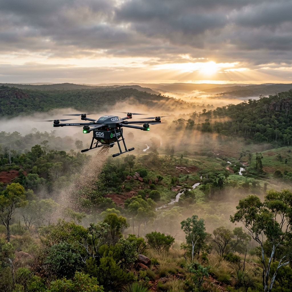
Global Drone Seeding delivers drone-enabled aerial seeding and spraying solutions that support environmental teams in deploying native seed mixes, and treating invasive species, across large and complex landscapes. By reducing reliance on ground crews and heavy equipment, the approach minimises site disturbance, lowers operational complexity, and improves safety.
Four Precision Services.
One Mobilisation.
Aerial Seeding
GPS-guided deployment of native seed mixes across complex terrain. Pre-mobilisation calibration matched to your specific seed mix.
Learn MoreWeed Spraying (Liquid)
Targeted liquid treatment for invasive species and pest control. Precision application across difficult terrain with minimal impact.
Learn MoreWeed Spraying (Granular)
Broadscale granular weed treatment for large landscape areas. Effective where liquid application is impractical.
Learn MoreFertilising (Granular)
Targeted granular fertiliser application supporting vegetation establishment. Scalable. No soil compaction. No land disturbance.
Learn MoreThe Standard Ground Crews
Can't Match.
Risk Reduction
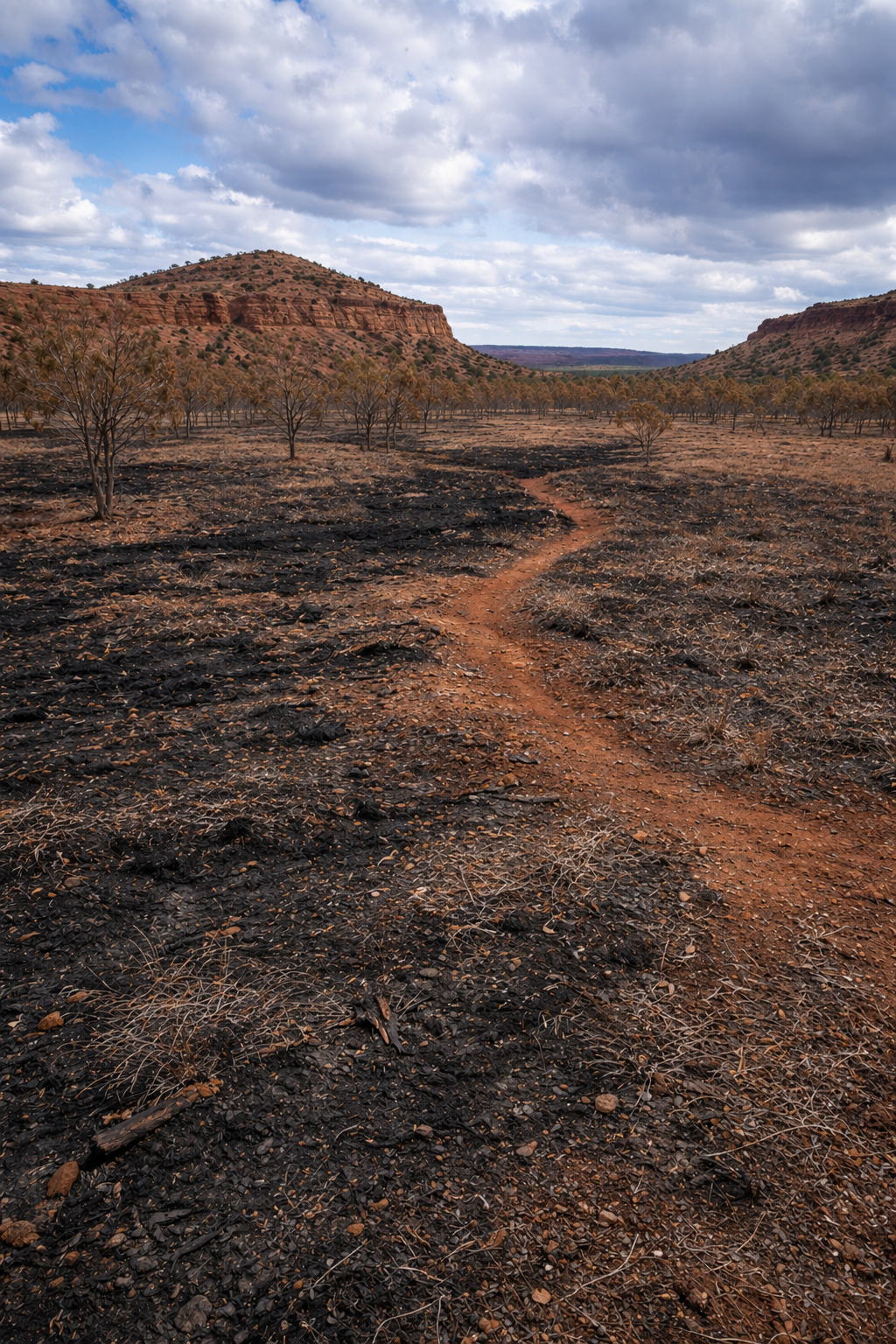
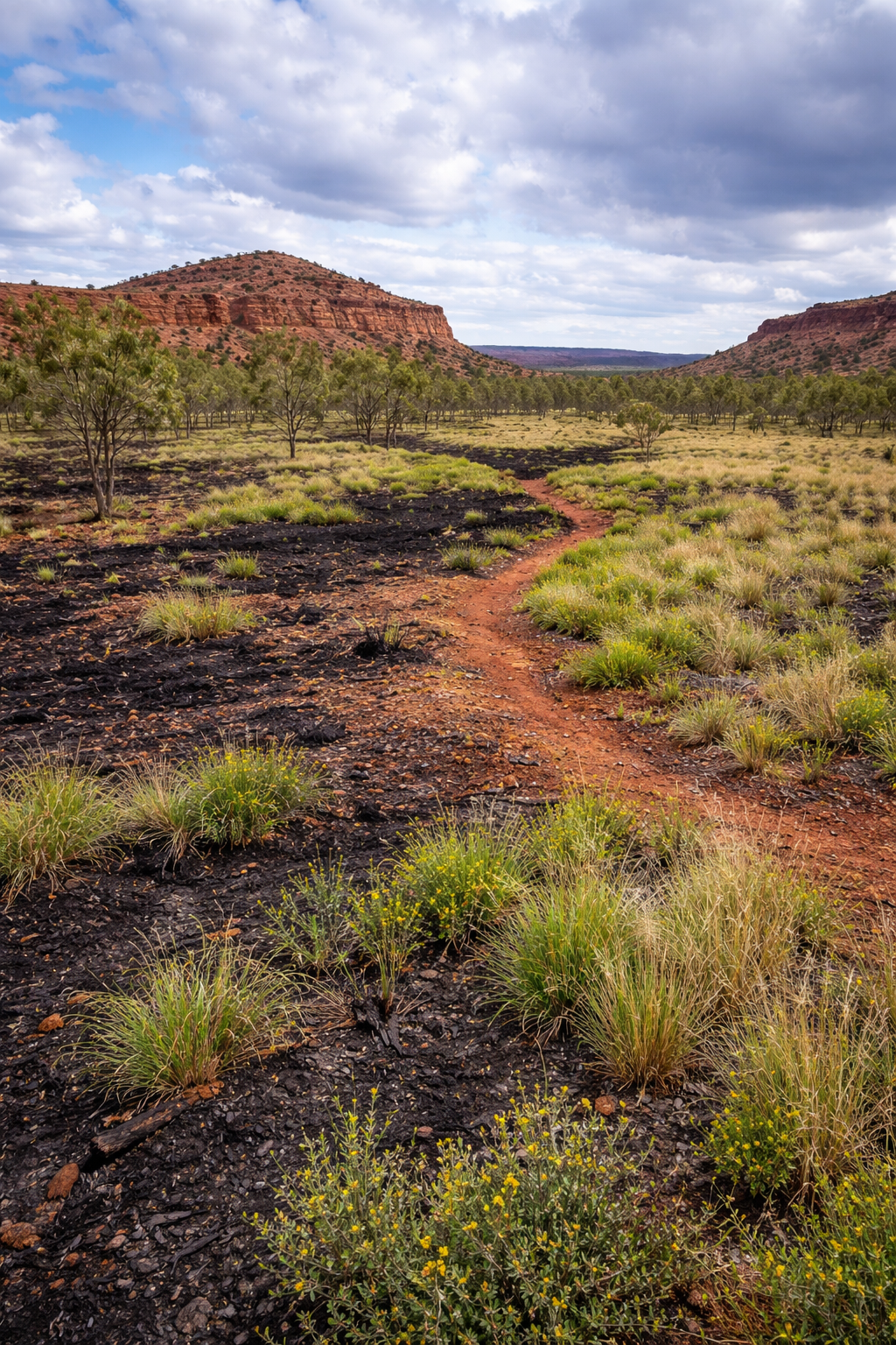
Fewer people, less equipment, less time on-site. Our approach dramatically reduces the operational footprint and keeps ground crews out of high-risk, inaccessible terrain.
High-Speed Seeding
Each drone seeds up to 20 ha per day. SWARM operations deliver up to 50 ha daily — faster than any traditional ground-based method.
World-Leading Expertise
Backed by specialist aerial operations expertise and field-tested teams equipped for complex, remote, and highly regulated environments across Australia.
Guaranteed Reliability
Equipment and teams proven under the harshest field conditions — extreme heat, remote locations, post-rainfall tight windows.
Zero Soil Disturbance
No compaction. No land disturbance. Drone deployment preserves soil structure and seed integrity — critical for long-term revegetation.
Full Traceability
GPS-verified flight data, ESRI shapefiles, photographic QA records, and a complete Project Delivery Report on every project.
Simple In. Precise Out.
From initial briefing to final delivery report — every step is structured, transparent, and executed with precision.
Briefing & Scoping
Customer provides seeding area shapefiles, seed list, and a seed sample.
Briefing & Scoping
Customer provides seeding area shapefiles, seed list, and a seed sample.
Planning
We jointly develop a Project Delivery Plan covering schedule, resources, logistics, and safety.
Calibration
Seed spreader calibrated to the correct density rate using the customer-supplied sample.
Deployment
Our team deploys GPS-guided drone systems to deliver precise, consistent seed application.
Reporting
Project Delivery Report including aerial flight paths and mapping data issued on completion.
The Numbers That Matter.
Ready To Advance Your
Rehabilitation Program?
Our commercial team will work with you to structure the most cost-efficient pricing against your specific requirements.
Request A Proposal Today